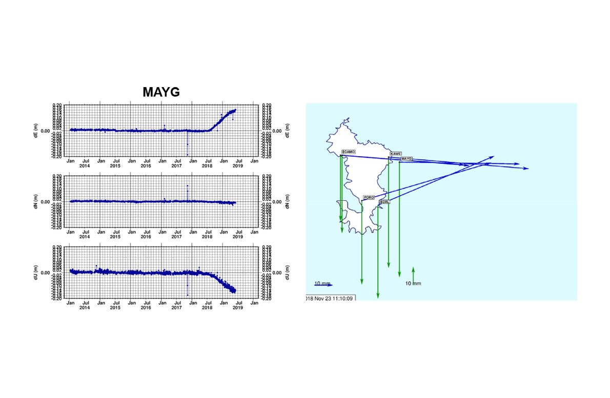


Since May 2018, the archipelago of Mayotte has been the scene of an almost uninterrupted series of large-scale seismic events. The intensity of this seismic activity has attracted the attention of scientists, who are seeking to understand the causes. Geodetic observations from the four Permanent GNSS Network (PNG) stations on the island have played a crucial role in this. These include a station managed by CNES, two TERIA stations and a Lél@ station. These high-precision instruments have made it possible to detect a significant displacement of the island since July 2018.
The data collected show that Mayotte is moving eastwards at a rate of around 1.5 cm per month. At the same time, the island is also sinking at a rate of around 1.2 cm per month, indicating significant vertical deformation. Faced with these abnormal movements, geophysicists were quick to formulate a hypothesis in November 2018: the origin of these phenomena could be volcanic.
This hypothesis, initially based on geodetic data, was confirmed in May 2019 thanks to a major discovery. During an expedition led by the oceanographic vessel Marion-Dufresne, researchers identified an underwater volcano some fifty kilometres east of Mayotte. This discovery corroborates previous observations, providing a tangible explanation for the tectonic movements and seismic activity that have been shaking the archipelago for several months.